 Entrance
Nature reserves and national parks of the Volga region. Specially protected natural areas
A unique network of various specially protected natural areas has been formed in the Samara region. It is based on protected areas of federal significance: Zhigulevsky State Nature Reserve named after. I.I. Sprygina, Samarskaya Luka National Park, Buzuluksky Bor National Park; as well as protected areas of regional significance and other protected areas.
Zhigulevsky State Reserve named after. I.I. Sprygina.
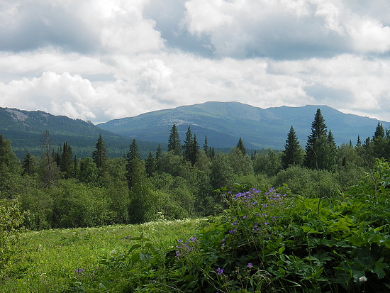
The reserve is located in the Middle Volga region in the most elevated part of the Samara Luka - the Zhiguli Mountains - in the western part of the Samara region.
The reserve is particularly distinguished by its diversity of flora and fauna.
The floristic richness of the reserve is currently determined by 1149 species of autotrophic plants.
Of the 1,022 species of vascular plants in the reserve's flora, 178 species are recognized as having special scientific significance.
Most of the reserve's territory (95%) is covered with forests.
In the reserve, encounters of 229 species of birds (about 80% of the avifauna species of the Samara region) were reliably recorded, of which
150 are regularly found on the territory and near the borders of the reserve
The modern composition of the mammal fauna includes 48 species of animals belonging to 6 orders, 15 families and 34 genera (which is 63% of the number of mammal species in the Samara region).
The invertebrate fauna is also very diverse - more than 7 thousand species
At the same time, even in specially protected natural areas there are evidence of processes of degradation of ecological systems. The area of pine forests has decreased significantly here, and tall oak forests have almost completely disappeared. Economic development of the territory of Samara Luka caused significant damage to the flora and fauna.
Samarskaya Luka National Park
Modern ecosystems of Samarskaya Luka are a refuge for a large number of endangered plants and animals. In the flora of Samarskaya Luka, 1302 species of vascular plants are noted, among which 102 species are endemic and 60 species are relict plants. 44 species of vascular plants are extremely rare.
The degree of preservation of natural territorial complexes in the park is lower than in the Zhigulevsky Nature Reserve, while the species diversity of the national park is richer due to floodplain species - 61 species of mammals, 213 species of birds (about 150 nesting), 9 species of reptiles, 8 species of amphibians and about 45 species of fish.
As a result of intensive logging carried out before the organization of the national park, the structure of forest communities was greatly changed. Mostly, middle-aged forests predominate, dominated by one of the species: linden, oak, and aspen.
The condition of trees and shrubs based on the results of 2011 is assessed as satisfactory.
At the end of 2011, there was no noticeable decrease in the number of main species of vertebrate animals.
Buzuluksky Bor National Park
On the territory of the Samara and Orenburg regions in the floodplain of the Samara River, its tributaries of the Borovka and Koltubanka rivers, on the first and second floodplain terraces there is a unique forest area Buzuluksky Bor.
By promoting rainfall and snow accumulation, facilitating the transfer of surface meltwater into groundwater, boron restrains soil erosion and regulates water reserves in the basins of the Borovka, Chertakly, Mushtai, Koltuban, Taneyevka and others rivers.
In the modern vegetation cover of the Buzuluk forest, according to data carried out over last years floristic studies, there are 679 species of vascular plants belonging to 353 genera, 96 families, 7 classes and 5 divisions. The forest area is home to 55 species of mammals, about 180 species of reptiles, 6 species of amphibians, and 24 species of fish. Of the total number of forest inhabitants, some species are protected and are listed in the Red Book of the Russian Federation, Orenburg and Samara regions.
Specially protected natural areas regional significance
The system of specially protected natural areas of regional significance in the Samara region is currently represented by one, the most numerous category of protected areas - natural monuments of regional significance (in 2011 there were 214 of them).
The share of the area of protected areas of regional significance in the total area of the Samara region in 2011 reached 0.8%.
As of December 31, 2011, the inventory and land management of all existing natural monuments was completed, their boundaries were approved, and the provisions of natural monuments of regional significance were developed and approved by the Government of the Samara Region.
RpeviewPicture:

The Volga region covers territories in the middle and lower reaches of the Volga. These places are famous for their varied and attractive landscapes, which are protected in small but quite numerous nature reserves and national parks. The Volga region is usually divided into the right bank Privolzhskaya Upland, where, among others, the Volga Forest-Steppe and Prisursky nature reserves and the Samarskaya Luka National Park are located; and the left bank Trans-Volga region, where the Kerzhensky Nature Reserve is located.
The ethnic diversity of the Volga region is great, which is manifested in handicrafts, costumes, folklore of the Mari, Chuvash, Tatars and other peoples who have inhabited these places for a long time.
All protected areas of the Volga region have their own characteristics that make them worth visiting. Thus, in the Nurgush Nature Reserve some of the most primitive forms of dinosaurs were found, in the oak forests of the Mordovian Nature Reserve there are huge trees over 300 years old, and in the Smolny National Park in the spring you can watch the migration of waterfowl.
Republic of Mari-El, Kilemarsky and Medvedevsky districts
History of creation
The Bolshaya Kokshaga State Nature Reserve was created in 1993. Before this, there was a Mari Nature Reserve on the territory of Mari El, which completely burned out in the hot, dry summer of 1972.
The purpose of creating the reserve is to protect forest ecosystems on the border of southern taiga and broad-leaved forests. Its total area is 21.4 thousand hectares.
The territory of the reserve is represented by river and lake-glacial plains. The highest point is 132.2 meters above sea level.
The largest river, the Bolshaya Kokshaga, a left tributary of the Volga, crosses the territory of the reserve in its central part. In total, about 20 rivers, rivers and streams flow here. There are also three lakes on the territory of the reserve - Shushier, Kosheer and Kapsino.
The climate is temperate continental, with frosty winters and moderately hot summers.
Diversity of flora and fauna
The territory of the reserve is covered mainly by pine and birch forests. There are few spruce forests. They are located in the northern part of the reserve, mainly in river valleys. In floodplain areas, along the river. B. Kokshaga, mainly oak and linden plantations grow, and along small rivers and streams - downy birch or black alder with a small admixture of spruce. In the vast depressions there are swamps of a transitional type, also covered with downy birch and black alder. Small areas of the floodplain are occupied by water meadows.
The fauna here is typically forest. There are numerous elk, white hare, squirrel, and wild boar. Common predatory mammals include the pine marten, polecat, and ermine; a brown bear and a wolf meet.
The most common birds are capercaillie and black grouse. The gray crane, gray heron, as well as eagle owls, goshawks and sparrowhawks nest here. Black stork, snake eagle, peregrine falcon, osprey, listed in the Red Book of the Russian Federation, were noted.
What to watch
Several ecological trails and excursion routes have been organized in the protected zone of the reserve and the surrounding area. Hiking routes lead from the village of Starozhilsk to Lake Soleny, or from there to Lake Paleny.
The water route runs along the Bolshaya Kokshaga River from Starozhilsk to the village of Kokshomary, and the walking route - “Nature Monuments”, from Starozhilsk to the village of Markitan.
The Museum of Nature and Ethnography of the Mari People will soon be created here. A large amount of material on the history of the Mari people has already been collected, and a premises for the museum has been chosen.
Buzuluksky Bor National Park
Orenburg region, Buzuluksky district and Samara region, Bogatovsky, Borsky and Kinel-Cherkassky districts
Founding history
Buzuluksky pine forest is a unique forest in the steppe Trans-Volga region. This site dates back to the post-glacial period, its age is 6-7 thousand years. Then island pine and birch forests appeared on this territory. The pine forest itself, with an undergrowth of deciduous plants, formed about three to four thousand years ago.
To protect these relict pine and pine-deciduous forest crops on the border of the Orenburg and Samara regions, the Buzuluksky Bor national park was established in December 2007. The area of the protected area is about 106.8 thousand hectares.
Physiographical features
The Buzuluksky forest is located 15 km north of the city of Buzuluk in a vast river basin with a depth of 100-150 meters. The Borovka River flows along the massif, in the south of the forest it flows into the Samara River.
More than 60 thousand hectares of the Buzuluksky forest are occupied by sands, the thickness of which in some places reaches 90 meters. The vastness of the sand massif is explained by the fact that there was probably an ancient sea in the area of the forest. Around the forest there are steppes, which have long history economic development.
Diversity of flora and fauna
The specificity of the park's landscape lies in the unique combination of forest, steppe, meadow and swamp communities. More than two thirds of the massif is occupied by pine forests. Among them, the most typical are mossy, complex and grassy forests. The attraction of the forest is two pines aged 300-350 years.
Bor is bordered on almost all sides by a strip of deciduous forest bordering the steppe. A strip of deciduous forests - oak, poplar and alder forests - stretches along the Borovka River, separate sections of aspen and birch forests are scattered throughout the forest.
On the territory of the park, the growth of 13 species of rare plant species included in the Red Books of Russia and the Orenburg region was noted.
The fauna of terrestrial vertebrates includes 55 species of mammals, 180 species of birds, eight species of reptiles, six species of amphibians, and 24 species of fish. A very high proportion of species included in the Red Book Russian Federation. These are the Russian muskrat, the European mink, and the river otter. The park is inhabited by elk, roe deer, wild boar, badger, marten, common squirrel, and beaver.
The IUCN Red List includes the white-tailed eagle, peregrine falcon, bustard, little bustard, lapwing, and Russian muskrat living in the Buzuluk Forest.
What to watch
Currently, the Buzuluksky pine forest is a most valuable object of historical and cultural heritage, where, starting from the 80s of the 19th century, standard forest plantations were created that enriched the world's forestry and forest reclamation science. In the summer, in the park you can enjoy the purity of fresh air, the vibrant beauty of the landscapes, sit in silence on the banks of a river or lake and go fishing or pick mushrooms and berries. In winter, go skiing along the snow-covered hills and admire the centuries-old pine trees covered in snow.
Republic of Tatarstan, Zelenodolsk and Laishevsky districts
.jpg)
Founding history
The idea of organizing a reserve in these places arose back in 1917, but it was realized only in 1960, when the Volga-Kama Reserve with a total area of more than 10 thousand hectares was created. It consists of two separate sections - Raifsky and Saralovsky, located at a distance of about 100 km from each other.
Physiographical features
The formation of the relief and hydrological network of the reserve is associated with the history of the development of the Volga and Kama valleys, which arose long before ice age on the Russian Plain. The territory of the Raifsky section of the reserve is confined to a wide depression of the Middle Quaternary terrace of the Volga, the Saralinsky section is located at the confluence of the Volga, Kama and Mesha rivers. Here, from the so-called Bald Mountain, there are wonderful views of the protected forest and reservoir.
The reserve is home to the very beautiful Raifa Lake, into which the Sumka River flows. There are other, smaller forest lakes.
The climate of the reserve is moderate continental. The average temperature of the coldest month - January -10.2ºС, the warmest - July +19.3ºС; The absolute minimum temperature reaches -41ºС, the absolute maximum +36ºС.
Diversity of flora and fauna
More than 90% of the reserve's area is covered with forests. In the Raifa area there are spruce-fir forests, various types of pine forests, oak forests, mixed forests, linden forests, birch forests, aspen forests, and floodplain alder forests. There have been no final fellings here since the 16th century, so overmature forests with 200-300 summer pines, spruces, and oaks have been preserved. There are various swamps, mostly transitional.
The Saralovsky area is dominated by pine and linden forests. Steppe pine woodlands are confined to sandy hills and terrace ledges, and mixed-grass feather grass steppe communities are found.
Species listed in the Red Book of Russia such as feather feather grass, red pollenhead and others grow in the reserve.
The fauna combines taiga, oak forest and steppe complexes. Hares live here - hare and hare, elk, wild boar, muskrat. Occasionally there are wolves, bears, lynx, ermine, polecats, roe deer, and reddish ground squirrels.
Birds are numerous: black grouse, hazel grouse, gray partridge, quail, dove, wood pigeon, corncrake, crake, gray heron is common.
What to watch
In the Raifa section, you will be given excursions to the nature museum and the arboretum of the reserve, founded in 1921. About 500 species of trees and shrubs from North America, Europe and Asia are collected here.
On the shore of Lake Raifa there is the Raifa Monastery of the 17th century, which you can also visit on a guided tour.
Samara region, Stavropol district
.jpg)
History of creation
The reserve was first organized in 1927 under the name “Middle Volga”. In the period from 1935 to 1966 it was closed several times, but since 1966 it has been functioning again, although its area has become smaller - now it is 23 thousand hectares.
Physiographical features
The reserve includes the central Zhiguli massif, bounded from the west by the Morkvashinskaya valley and from the east by the Shiryaevskaya valley. The height of the mountain range within the reserve ranges from 250 meters above sea level in the west and east to 371 meters in the center. Within the reserve, the ridge is dissected by two valleys: Bakhilova Polyana and Molebny Ravine.
The climate in the reserve area is continental with hot summers and frosty winters. The coldest month is January (-11ºС). The warmest month is July (+20ºС). The absolute maximum air temperature over the past 20 years was +41ºС, and the absolute minimum -44ºС.
Diversity of flora and fauna
The flora of Zhiguli is amazing and diverse. Next to the typical representatives of the forest-steppe of central Russia grow taiga and desert plants, inhabitants of the warm Mediterranean, harsh Siberia and the Urals. Inhabitants of northern taiga forests - bearberry, bifolia, some ferns; desert plants - wormwood solyanka, thin-legged rigid-leaved, Popov's forget-me-not; Mediterranean species - speckled globe beetle, alpine aster.
The so-called “mountain pine forests” with a number of rare and relict species are very interesting. Zhiguli's narrow-local endemics include Zhiguli's spurge, kachim, sunflower and others.
The richness and features of the Zhiguli fauna are explained by a number of favorable circumstances: the relative antiquity of the territory, geographical location, favorable conditions for the conservation of species during periods of glaciation, a wide variety of natural complexes and their best preservation compared to surrounding areas.
The largest representatives of the animal world are ungulates: elk, wild boar and roe deer. Moreover, it is curious that a few centuries ago on Samarskaya Luka the wild boar was killed by hunters. As a result of organized protection in the second half of the 20th century, its numbers began to grow again, and now the wild boar is the most numerous species of ungulates in the territory.
What to watch
There are several routes on the border of the reserve: “Spring Stone Bowl”, “Adits Burlak”, “Mount Strelnaya”. You can combine their passage with a vacation in the Samarskaya Luka National Park, which adjoins the reserve from the west, south and east.
Kerzhensky Nature Reserve
Nizhny Novgorod region, Borsky and Semenovsky districts

History of creation
There were plans to create a reserve even before the Great Patriotic War, but they could only be realized in 1993, it was then that the Kerzhensky Nature Reserve was founded. Nine years later, it was included in the international network of UNESCO biosphere reserves with the name “Nizhny Novgorod Trans-Volga Region”.
The reserve is engaged in the protection of intact southern taiga ecosystems of the Volga region, as well as wetlands. One of the important reasons for the creation of the reserve was also the presence of muskrats in the area.
Physiographical features
The reserve is located on the left bank of the Kerzhenets River, 50 km from its confluence with the Volga. The territory is a generally flat lowland with sand dunes, hillocks and ridges located on it.
Within the reserve, a number of tributaries flow into the Kerzhenets: the rivers Makarikha, Rustaichik, Vishnya, Pugai and others.
The climate is moderate continental. Average temperatures in January are -12ºC, in July +19ºC.
Diversity of flora and fauna
More than half of the reserve's territory is occupied by pine forests. In addition to them, birch forests and some spruce forests are common. Alder forests grow along the valleys of forest rivers and streams, and in wetlands.
The Red Data Book of Russia includes Neottianthe capulata, Traunsteiner's palmroot, and red palmate that grow here.
The permanent resident animals are the brown bear, pine marten, polecat, ermine, European mink, wolf, lynx and beaver. There are birds such as capercaillie, black grouse, hazel grouse, and Russian partridge. Among the rare species of animals, the Russian muskrat is noted. Birds include black stork, golden eagle, peregrine falcon, osprey and a number of others.
What to watch
The reserve is located in very picturesque places. It is believed that this is where the taiga begins.
One of the main local attractions is the village of Lykovo, founded in the 17th century. The royal forester was exiled here, having done something wrong before the king. But the forester did not lose heart, he began to tear the bast and float it to the Makaryevskaya fair, from which he became rich... And now in the village there are preserved houses of the 19th century with wood carvings, and there is the skeleton of a church that was once burned down by a lightning strike.
The reserve offers excursions along the eco-trails “Night Life of Nature” and “Floodplain of the Kerzhenets River”.
Mari Chodra National Steam To
Republic of Mari El, Morkinsky, Zvenigovsky and Volzhsky districts

History of creation
Mari Chodra National Park or Mari forest"in Russian, was created in 1985. The park's area of 36.6 thousand hectares is covered with beautiful pine forests and deciduous forests.
The main objectives of the park were the preservation and restoration of landscapes, characteristic flora and fauna, and natural monuments; protection of natural complexes, including lakes of collapse-karst origin, and their use for recreational, educational and scientific purposes.
Physiographic conditions
The national park is located in the southeast of the Mari El Republic, in the river basin. Ilet is a left tributary of the Volga, and is part of a strip of mixed forests in the forest zone. The territory is a gently undulating plain with absolute heights of 75-125 meters above sea level.
There are a large number of lakes and rivers in the park. The main river of the park is the Ilet with its left-bank tributaries: Yushut, Arbaika, Uba, and the Petyalka River flows into it from the right. During the warm period of the year, the river's water content allows tourist boats to pass through. In the area of Klenovaya Mountain, more than 20 springs flow into Ilet. The most significant is the Green Spring, flowing at the foot of the mountain on the left bank of the Ilet.
Forest karst lakes are very clean and transparent, some of them - Yalchik, Glukhoe, Kichner, Shulgandan - are natural monuments.
The climate of the area where the national park is located is temperate continental, characterized by relatively hot summers and frosty winters with stable snow cover. The average temperature of the warmest month (July) is +18.3°С, the coldest (January) is -14.1ºС.
Diversity of flora and fauna
The park is dominated by forest vegetation, where the largest share is made up of pine forests, spruce forests are represented in a mosaic, and there are oak groves. Various types of birch and aspen forests occupy about a third of the park's area.
Rare species of plants growing in the park on the border of their habitats include: laxative jockstrap, wood apple tree; red-fruited crowberry, common heather, dye's dock, Arnelle's sedge, Ural cicerbita and others.
The fauna of the park includes taiga species - brown bear, elk, wood grouse, hazel grouse; species of coniferous-deciduous forests - yellow-throated mouse, squirrel, green woodpecker; as well as forest-steppe species - brown hare, field mouse, reddish ground squirrel, common hamster. The red fox is common. The muskrat also lives in the park - a rare species listed in the Red Book of the International Union for Conservation of Nature and the Red Book of the Russian Federation.
The rivers and lakes of the park are home to more than 43 species of fish - such as catfish, pike, golden and silver crucian carp, carp, tench, and bream. The channels of the Ilet River are home to a rare species - European grayling.
What to watch
The national park is an ecologically clean, most picturesque corner of Mari nature. Here you can find traces of bears and elk, mighty trees felled by beavers, and rare plants.
Interesting historical sites are the old Kazan Highway and the Pugachev Oak. According to ancient legends, near this oak tree, pursued by the tsarist troops, Emelyan Pugachev stopped to rest with his troops. From here he observed the burning of Kazan. The size of the oak tree is very different among the trees. This is a gigantic tree with a powerful trunk, the diameter of which is 159 cm.
You can explore nature and see all the attractions of the park by walking along numerous horse, water or walking routes, accompanied by experienced park guides.
Mordovian Nature Reserve
Republic of Mordovia, Temnikovsky district

History of creation
The Mordovian Nature Reserve was created in 1935 to preserve and restore the forest of the southern part of the taiga zone with spruce plantations, preserving and enriching the animal world through the acclimatization of the most valuable species.
The reserve was given the name of the famous political figure Pyotr Smidovich, who did a lot to protect the nature of Mordovia.
Physiographical features
The reserve lies in the interfluve of the Moksha and its right tributary, the Satis, the relief is poorly dissected, characterized by small elevations between the floodplains of the rivers and ravines.
The main river of the reserve is Pushta. Moksha, Satis, Arga and a number of others also flow here. In summer, the beds of most rivers are waterless. There are many oxbow lakes in the reserve, the largest of them being Inorkp and Valza.
The climate of the territory is moderate, typical of mid-latitudes. The average temperature in January is -12°C, in July +20°C. The seasons are characterized by sharp fluctuations in temperature.
Diversity of flora and fauna
Almost the entire territory of the reserve is covered with forests, about half of which are pine forests. Birch forests predominate in the western and eastern parts, and linden forests in the central part. In the floodplain of Moksha, oak forests grow at the age of 140-150 years, and occasionally there are even giants over 300 years old.
Among the rare species in the reserve are the lady's slipper, the red pollenhead, and the reviving moonflower, which has not yet been found anywhere else in Mordovia.
It was already mentioned above that the reserve is engaged in acclimatization on its territory various types. In total, six species were brought to the territory, including the river beaver, which had previously been practically exterminated in the region, the Russian muskrat, sika deer, Ascanian deer, Siberian roe deer and bison.
The reserve contains birds listed in the Red Book of Russia, including saker falcon, golden eagle, little bustard, black stork and others.
Nechkinsky National Park
Udmurt Republic, Votkinsky, Zavyalovsky and Sarapulsky districts

Founding history
The Nechkinsky National Park, located in the middle reaches of the Kama, is very popular among tourists who love outdoor recreation.
The park was established in 1997 for the protection and recreational use of valuable natural complexes of the Kama River valley - taiga forests, mixed forests and forest-steppe, numerous swamp complexes. Its area is now almost 21 thousand hectares.
Physiographical features
The national park is located in the middle reaches of the Kama River, on the coast of the Votkinsk reservoir. The right and left bank parts of the territory are very different: the Kama region is an elevated plain, densely and deeply dissected by small river valleys, ravines and ravines, the left bank is represented by a floodplain and above-floodplain terraces.
The main rivers of the park, the Kama and its tributary the Siva, are of a typical flat nature and have low slopes. The Kama, along almost its entire length, has a steep, steep right bank with a ledge height in places of more than 160 meters and an almost even flat left bank.
The territory of Nechkinsky Park is characterized by a moderate continental climate with long cold winters, well-defined but short transition seasons - autumn and spring, warm summers. The warmest month is July, the average temperature is +19ºС. In January, the average temperature is -15ºС, and the minimum is -49ºС.
Diversity of flora and fauna
The territory of the Nechkinsky National Park is located in the subzone of coniferous-deciduous forests.
The flora of the park is characterized by increased diversity - more than 70% of the species of the entire natural flora of Udmurtia grow here in a small area, and three species are found only on its territory. This is the reed butterbur, the creeping umbilical cord, and the field butterbur.
Four plant species are listed in the Red Book of Russia. These are Lady's slipper, Neottianthe capulata, Calypso bulbosa, and Red pollenhead.
Among the representatives of the animal world, five species of birds listed in the Red Book of Russia are found on the territory of the national park - black stork, osprey, white-tailed eagle, eagle owl and curlew.
Tourists can observe life in natural conditions common hedgehog, red noctule, fox, elk, squirrel, chipmunk, muskrat, mountain hare.
What to watch
There are several interesting natural monuments in the park. Thus, the mouth of the Siva River is interesting as a spawning ground for valuable fish species, the Nechkino tract is a standard watershed route, and the Sidorov Mountains are a landscape natural monument.
There are also several archaeological monuments - sites from the Stone and Bronze Ages, an early Iron Age fortification.
Park workers conduct ecological excursions, which include an introduction to the life of the inhabitants of the sites wildlife, as well as with coastal and river landscapes.
Tourist routes follow picturesque paths and are equipped with places for relaxation and swimming.
Nurgush Reserve
Kirov region, Kotelnichesky district
History of creation
The Nurgush Nature Reserve was created in 1994 on the site of the reserve of the same name, which existed for more than 40 years. The total area of the reserve is almost six thousand hectares. The purpose of its creation is to protect intact typical middle taiga landscapes in the floodplain of the Vyatka River with characteristic flora and fauna.
Physiographical features
The relief of the reserve is an alternation of long narrow elevations and depressions. Depressions are occupied by channels and small reservoirs, deep depressions (4-6 meters) are occupied by floodplain lakes and oxbow lakes. In the area of the reserve on the Vyatka River there are 3 islands: Pishchalsky, Bezymyanny and Oseredok.
The Vyatka River is the main river of the reserve; it delineates the boundaries of the territory in the north, east and south. In addition to several other rivers, there are more than 80 lakes on the territory of the reserve, the largest of which are Krivoe, Chernoe and Turgush. These lakes are located in the center of the reserve and are connected to each other by permanent channels. During spring floods, almost the entire reserve is flooded with water.
The climate of the territory is moderate continental with long, cold, snowy winters and moderately warm, short summers. The air temperature of the warmest month, July, is +18ºС, and the coldest month, January, is -13.9°С.
Diversity of flora and fauna
The reserve is a continuous array of deciduous-coniferous swampy forests. Coniferous forests occupy about 20% of the area, including spruce, pine and fir forests. Significant areas are occupied by secondary deciduous forests: aspen and birch forests.
Here you can find lady's slipper, bulbous calypso and Tarunsteiner's fingerroot, which are included in the Red Book of the Russian Federation.
A typical feature of the fauna of the reserve is that it includes species characteristic of steppe, taiga and nemoral systems.
Typical species are muskrat, common shrew, muskrat, American and European mink, and otter. Bears and badgers are not encountered very often due to the fact that almost the entire area is flooded with water.
There are many species of birds whose lifestyle is associated with ponds and swamps. Among the rare species listed in the Red Book of the Russian Federation, osprey, white-tailed eagle, black stork, red-breasted goose, lesser white-fronted lesser white-fronted eagle and others live here.
What to watch
Not far from the reserve there is one of the world's largest deposits of dinosaurs, and their most primitive forms. You can learn more about these ancient animals in the paleontological museum of the city of Kotelnich.
There are many places in the reserve that are attractive to researchers, artists and just leisure travelers.
For those who like to collect the gifts of nature, there is a real expanse here, with many different berries and mushrooms. Fishing is good on Vyatka: in May-June there are good catches of pike, bream, and saberfish. In winter, bream, perch, and pike are caught from the ice.
Volga forest-steppe Reserve
Penza region, Kuznetsk, Kameshkirsky, Neverkinsky, Kolyshleysky and Penza districts
.jpg)
History of creation
Although the Privolzhskaya Forest-Steppe Nature Reserve dates back only to 1989, the first protected area, the Poperechenskaya Steppe, was organized here back in 1919.
The main goal of the reserve is to preserve the unique steppes of the northern type. In addition to three steppe areas, the reserve also includes two forest areas, and its total area is 8.3 thousand hectares.
Physiographical features
The reserve is located in the southwest of the Volga Upland, within the main watershed between the Volga and Don.
Within the “Upper Reach of the Sura” section, the Sura River flows through the reserve with numerous small tributaries. There is also a small lake Svetloye of glacial origin. The Borok site is limited on the south-eastern side by a tributary of the Sura, the Kadada River. On the Kuncherovskaya Steppe site there is a sedge-grass swamp.
The climate of the territory is temperate continental. Winter is moderately cold, the average temperature in January is about -12°C. Summer is warm, the average temperature in July is about +19°C.
Diversity of flora and fauna
The flora of the reserve is extremely diverse. The vegetation within the reserve is dominated by pine and mixed forests, oak forests and meadow steppes. The feather grass, swaying with silvery threads in the wind in June, gives the meadow steppes a unique appearance.
The Red Book of Russia includes 4 types of feather grass found in the reserve: feather-leaved, feathery, beautiful and Zalessky feather grass.
The location of the reserve in the forest-steppe zone explains the presence here of animal species characteristic of both forests and steppes. Pine marten, badger, elk, and wild boar live here. Rare for the region, lynx, otter, ermine, river beaver, steppe pied, and speckled ground squirrel are found.
The role of the protected area as a reserve for hunting and commercial animal species is important. Here, in winter, about 30 moose, dozens of wild boars, hundreds of wood grouse and black grouse find shelter.
The world of birds in the reserve is diverse. Among the rare species, the common honey buzzard, the golden eagle, the saker falcon, and the bustard were noted; nesting of the steppe harrier, rare for the region, was recorded.
What to watch
The area where the reserve is located is interesting for both natural and cultural attractions. In the village of Radishchevo you can visit the museum complex of the noble estate of the 1st half of the 18th century A.N. Radishchev, in the villages of Ablyazovo and Demino there are Orthodox churches of the 18th century, and in Demino there are also two Muslim mosques. In the village of Tikhmenevo there is a museum of the history of the surrounding villages, culture and life of the Russian population and a visitor center of the reserve.
In the protected area of the Borok protected area you can swim and fish; in the Kuncherovskaya Forest-Steppe area you will be offered an unusual ride on a horse-drawn cart, during which you will get acquainted with unique plant associations, soils and plant species.
On the eco-trail in the protected zone of the “Upper Sura” section, you will be introduced to the types of forest vegetation, flora and fauna, and traditional types of environmental management.
Very small groups can visit protected areas to observe and photograph beaver settlements.
Prisursky Reserve
Republic of Chuvashia, Alatyrsky, Yalchiksky and Batyrevsky districts

History of creation
The Prisursky Nature Reserve was created in 1995 to protect the southern taiga valley forests and wetlands with their inherent flora and fauna, especially for the protection of muskrats and seasonal concentrations of waterfowl. Later it was expanded by creating two new sites in the east of Chuvashia, which are important for the protection of fragments of steppe vegetation with marmot settlements. The total area of the reserve is 9.1 thousand hectares.
Physiographical features
The reserve is located on the western and eastern slopes of the Volga Upland. The average altitude of the territory is 120-180 meters above sea level, and the highest point reaches 221 meters. The territory has a slight slope from northeast to southwest.
The reserve is located on the right bank of the Sura River and is closely adjacent to its floodplain. Other rivers of the reserve are Lyulya and its tributaries: Orlik, Abachka, Sultanka.
The climate of the region is temperate continental, characterized by cold winters and hot summers. The average temperature of the coldest month, January, is -12.5ºС, the average temperature of the warmest month, July, is +19°С.
Diversity of flora and fauna
The territory of the reserve is dominated by northern broad-leaved forests with a small participation of spruce. The coniferous forests of Prisurye currently represent small areas of forests. Deciduous forests are dominated by birch, aspen, and linden; alder, oak, and willow are somewhat less common.
Rare and endangered plant species have been preserved in the Yalchik area: feather grass, protozoan onosma, steppe sage, Tsinger's astragalus and others. At the site in the Batyrevsky district, a relict steppe biogeocenosis has been preserved.
Typical representatives of the animal world are elk, bear, wolf, wild boar, hare, fox, marten and otter.
The main protected animal species in the reserve is the Russian muskrat.
The lakes are home to nesting grounds for a huge number of waterfowl and semi-aquatic birds. Birds recorded on the territory of the reserve include the Greater Spotted Eagle, Short-eared Eagle, Oystercatcher, Imperial Eagle, White-tailed Eagle, Osprey and Eagle Owl, which are listed in the Red Book of the Russian Federation.
What to watch
Particularly interesting for tourists is the section of the reserve located in the Batyrevsky district. Climbing up the slope from the highway, which runs 200 meters away, you can observe the life of a marmot colony and foxes living among the marmots.
In the floodplain of the Sura River, it is possible to organize horse riding routes through picturesque places, with views of the numerous lakes of the floodplain and the river itself. There is also an artesian well with healing hydrogen sulfide water.
And if you are attentive and careful, perhaps you will be able to see one of the Red Book inhabitants of the reserve.
Samara region, Stavropol, Volzhsky and Syzran districts

History of creation
The Samarskaya Luka National Park was founded in 1984 to preserve natural complexes, develop national culture, and create conditions for the development of sustainable tourism. There are many tourist centers and holiday homes in the park, with summer and winter routes. Residents of Zhigulevsk are especially lucky, to which the park adjoins in the south, so getting out into nature is not difficult for them.
Physiographical features
The national park is located in the eastern part of the Zhiguli Upland, in the bend of the Volga - Samarskaya Luka.
The northern part of the territory is occupied by the Zhiguli Mountains with the highest elevations up to 370 meters. To the south the relief decreases and turns into a plain.
The only river in the national park is the Volga. The Volzhskaya hydroelectric power station built here has a significant impact on the hydrological regime of the park.
The climate of the territory is continental. The temperature of the coldest month, January, is -10ºС, the warmest month, July, is +20ºС.
Features of flora and fauna
The territory of Samarskaya Luka includes forest-steppe and steppe pine forests, broad-leaved forests, steppes, and floodplain vegetation. The forests are dominated by deciduous trees, mainly linden, oak and aspen forests.
Of particular interest are the plants endemic to the Samara Luka and Zhigulevskaya Uplands: Volga carnation, Zhigulevskiy euphorbia, Zhigulevskiy euphorbia, Zhigulevskiy thyme. Relicts include common harem, Cossack juniper, Tatarian bark, Shiverekia Podolskaya, Robert's geranium and others.
The fauna of the park is diverse; about a third of the species of terrestrial vertebrate fauna in the park are located at the borders of their habitats.
The giant noctule and the Russian muskrat, which are listed in the Red Book of Russia, live here. Of the almost 20 species of birds listed in the Red Book, we can mention the ivory gull, the European black-throated loon, the long-legged buzzard, and the black stork.
What to watch
Of the archaeological sites, one of the most interesting largest settlements Volga Bulgaria of the 9th-13th centuries - Murom town. The fortified settlements of the Bronze and Iron Ages - Lbische, on Lysaya, Zadelnaya and Belaya Gora are also of interest.
Here is the house-museum of the wonderful Russian artist Ilya Repin, and in the village of Bolshaya Ryazan there is a colorful ethnographic museum.
The territory is rich in natural resources for hiking, cycling, skiing and water tourism. A network of tourist routes has been laid throughout the park, the most famous of which is the Zhigulevskaya Around the World Tour.
Republic of Mordovia, Ichalkovsky district
.jpg)
History of creation
Picturesque landscapes, floodplain lakes, healing springs, dense forests - all this attracts tourists to the Mordovian Smolny National Park.
The park was created in 1995 to protect the typical landscapes of Mordovia, valuable from ecological and aesthetic points of view, as well as for their use for recreation.
The maximum length of the park from west to east is 35 kilometers, from north to south - 18, and the total area is 36.4 thousand hectares.
Physiographical features
The territory of the national park is confined to the northwestern part of the Volga Upland. The relief is moderately dissected, characterized by a significant network of ravines in its northeastern part. The maximum elevation - 217 meters above sea level - is located in the northern part of the park.
All rivers of the park belong to the basin of the Alatyr River, the left tributary of the Sura. These typically lowland rivers are characterized by a slight fall and relatively slow flow. In addition to rivers, in the park there are more than 30 springs, swamps and lakes, including two Dubove lakes - natural monuments.
The national park is located in the forest-steppe zone of the temperate zone. The average temperature of the coldest month - January -11.5ºС, drops to -47ºС were observed. The average temperature of the warmest month - July is +18.5ºС.
Diversity of flora and fauna
The park's vegetation is very rich and unique. The most common type of vegetation is pure and mixed pine forests. There are few pure spruce forests, but there are pine forests mixed with spruce. Broad-leaved forests are represented by linden and oak forests.
Rare species of aquatic flora are noted in the park - chilim, or water chestnut (a species included in the Red Book of the Russian Federation), large naiad, and small caulinia. These species are rare throughout central Russia.
In total, more than 40 species of vascular plants are included in the list of rare and endangered in the Republic of Mordovia. These are two-seeded sedge, grass pondweed, jellied sedge, graceful cotton grass, black cotoneaster and other species.
The fauna of the reserve has not yet been sufficiently studied. Elk, wild boar, pine marten, ermine, and beaver live here. Animals of the park such as the small shrew, common shrew, hazel dormouse, dormouse, river beaver, badger, European mink, lynx, roe deer and a number of others are listed in the Red Book of Mordovia. In addition, 18 species of animals are listed in the annexes of the Convention on International Trade in Endangered Species of Wild Fauna and Flora.
The park contains 7 species of birds listed in the Red Book of the International Union for Conservation of Nature. These are the greater spotted eagle, imperial imperial eagle, white-tailed eagle, steppe kestrel, steppe harrier, corncrake, great snipe.
Rivers and lakes are inhabited by pike, roach, rudd, tench, gudgeon, burbot, perch, ruffe, sleeper, silver crucian carp and other species.
What to watch
In the national park you can completely relax, enjoying clean air, forest lakes, berries and mushrooms. When staying at the summer camps, in the park administration building or sanatorium, do not forget to walk along the routes developed for you by the staff of the environmental education department. This way you will learn better about the nature of the park, see wonderful natural monuments - Oak Lakes, the “Nursery” tract, the “Yelnichnoe Lake” raised bog and other places.
In the spring, you can watch the passage of waterfowl in the floodplain of the Alatyr River, organize a picnic, swim, and pick mushrooms and berries at specially equipped areas with gazebos.
Khvalynsky National Park
Saratov region, Khvalynsky district

History of creation
The rounded sides of the hills bask in the sun and sparkle with the whiteness of the chalk outcrops. The lark's trill carries far, far away and calls you to follow you into the bottomless depths of the sky. The Volga attracts with its coolness, and the forests with a mysterious canopy, shimmering green colors and the bewitching smells of flowering herbs. All this is the Khvalynsky region.
The history of the formation of this territory is interesting. Hundreds of millions of years ago, here was the lowest point of the platform on which the Russian Plain now stands. All of it was covered by ancient seas; their waters remained on the territory of this region for the longest time. In the warm shallow waters of these seas, myriads of living creatures, ending their life, fell to the bottom, creating deposits of chalk and other sedimentary rocks up to several tens of meters thick.
About twenty million years ago, all this rose in the form of the young Volga Upland with its highest point in the vicinity of Khvalynsk. And in 1994, the Khvalynsky National Park was created here in order to preserve the unique natural complexes of the region.
Physiographical features
The park is located in the northeastern part of the Saratov Right Bank, at the highest Saratov region mountains This is a high plateau - 200-300 meters above sea level. The general character of the relief is elevated, rugged, undulating and hilly. Numerous ravines and gullies. The natural border in the east is the river. Volga, in the north and north-west the region borders on the Samara region, in the south - on the Volsky district.
In the Khvalynsky region, the Volga reaches its greatest depths - up to 22.5 meters. The flow speed, like all lowland rivers, is low.
The climate of the region is sharply continental with large daily and annual fluctuations in air temperature. The average January temperature is -13ºС (minimum -43ºС), July +21ºС (maximum +39ºС).
Diversity of flora and fauna
The forest vegetation of the park is formed by pine forests on chalk outcrops, pine forests on tertiary sands, as well as oak forests and linden forests on gray forest soils. The uniqueness of the park’s forests is also evident in the existence of “chalk” forests. The chalk pine is both a relic, endemic and a natural monument of the region.
21 plants found in the park, mostly relicts and endemics, are listed in the Red Book of Russia, including wormwood, fragrant gillyflower, thin-leaved peony, Volga cinquefoil, and beautiful feather grass.
The relict plants of the park include horsetails (field and wintering) and ferns (common bracken and rare ferns - lanceolate-crested shield and female stumpweed). Relicts also include double-spike conifer or kuzmichev grass and Scots pine.
The lady's slipper is included in the Red Book of the International Union for Conservation of Nature.
In the park there are brown hare, beaver, fox, wolf, badger, forest and steppe ferrets and other animals. Conditions are favorable for many birds of prey to live in the national park. It should be noted the importance of the high density of the marmot, which is the food source for the burial ground. The common buzzard, common kestrel, and common buzzard reach high numbers. During the winter period, a significant number of white-tailed eagles are observed.
Of the animal species listed in the Red Book of Russia, 3 species of insects (Hungarian ground beetle, stag beetle and steppe bumblebee), 7 species of birds and the steppe marmot, or bobak, are found in the park. The Red Book of the International Union for Conservation of Nature includes wolves, lynx and 29 species of birds, incl. gray crane, osprey, white-tailed eagle, saker falcon, eagle owl.
What to watch
In addition to the chalk pine, there are three more natural monuments in the park: “Mount Belenkaya Tract”, “Fragment of the Vorontsov-Dashkov Park”, “Khvalynskie Springs”.
The Belenkaya Mountain tract is distinguished by a huge variety of vegetation and the beauty of the landscape.
On the territory of the “Fragment of Vorontsov-Dashkov Park” a unique plant - introduced - comb fir is protected. A tree more than 30 meters tall grows next to the estate house.
The park's ecological trails pass through picturesque areas with interesting flora and fauna, and include sightseeing. Thus, traveling through the “Reserved Land”, you can learn a lot about the layering of the forest, about the life of the anthill and its inhabitants - ants, about the long-lived oak tree and much more from the life of plants, animals, and forest nature. Eco-trail “Monk’s Cave” includes a description of the historical and cultural features of the region, “Journey along the bottom ancient sea» will introduce you to the history of the formation of the Khvalynsky Mountains. The “Mikhailovsky Sunrises” trail is interesting, demonstrating to tourists the unique flora and fauna of the chalk outcrops and including a visit to snake lakes with healing mud. It is also worth walking along the “Land of Mushroom Mists” and other fascinating trails.
Excursions around the national park include, in addition to ecological trails, the Forest Museum and the Teremok open-air cage. The first inhabitant of Teremok was a baby camel. Now you will also see imperial eagle, spotted deer, wild boar, marmot, mandarin duck, silver pheasant and other animals there. Here you can feed a deer by hand. You can ride horses - in a saddle or on a cart, in winter - in a sleigh.
Chavash Varmane National Park
Chuvash Republic, Shemurshinsky and Batyrevsky districts

History of creation
The Chavash Varmane National Park was formed in 2003 on the territory of the Chuvash Republic with a total area of 25.2 thousand hectares.
Once upon a time, this territory was a contact zone between steppe nomadic and forest agricultural cultures. In the Bronze Age (2nd millennium BC) tribes of the Srubnaya culture lived here. In the 1st millennium, this territory was inhabited by Iranian-speaking Burtus, Turkic-speaking Khazars, and ancient Mordovians.
Since the time of the “wild field,” the territory was inhabited by representatives of all ethnographic groups of the Chuvash, but at the same time, here, first of all, the history, culture and life of the “Simbirsk” Chuvash were embodied.
Physiographical features
The territory of the national park is located in the northern part of the Volga Upland; the relief consists of a number of local watersheds. The predominant absolute heights are 120-160 m. The maximum heights are noted in the eastern part of the park (265 meters).
A large number of rivers and streams flow through the territory. The most significant are the White Abyss, the Black Abyss, Abamza, Khutamatvar and others. There are over 20 lakes and artificial reservoirs.
The climate of the area is temperate continental with fairly long cold winters and warm summers. The average temperature in January is -12.8ºС, in July +19.2ºС.
Diversity of flora and fauna
The basis of the park's flora consists of species characteristic of broad-leaved, coniferous-deciduous and pine forests, meadows and, to a small extent, steppe species. Unique in their significance are the preserved areas of indigenous mature forests with pine, spruce, oak, linden, naked elm, ash, and black alder.
Here you can find lady's slipper, bulbous calypso, and red pollenhead, listed in the Red Book.
The national park represents almost all species of vertebrates living in the Chuvash Republic. About 40 species live here close to the boundaries of their ranges.
The Red List listed golden eagle, short-eared snake eagle, imperial eagle, and osprey are protected here.
What to watch
There are eight hiking routes in the national park, located in the most picturesque places.
In the area of the national park, you can explore places where people once prayed and made sacrifices to pagan gods and spirits.
An important historical monument is the Karlinskaya (or Tetyushskaya) serif line. In the XVI - XVII centuries it was a serious barrier against the attack of steppe nomads on the Russian state.
In the villages of Shemursha, Bolshebuyanovo and Trekhboltaevo there are interesting local history museums that are also worth visiting.
Walking through nature reserves and national parks, you will want to take a closer look at their beauty. Admire the brightness and variety of flowers and leaves playing in the sun, feel how a barely perceptible breeze carries the subtle fragrance of flowers. The charm of nature in the parks is irresistible. And what pleasure you can get from watching animals!
"Bashkiria"
Founded in 1986, the park with an area of 83.2 thousand hectares is located on the southwestern slopes of the Southern Urals, west of the Ural-Tau watershed ridge, in the southeastern part of Bashkiria and includes the waters of the Nugush reservoir. The park was created with the aim of preserving the unique natural complex of mountain forests of the Southern Urals. The park has developed on-site beekeeping.The park is famous for its unique and rich museum, the author of which is Nature herself, Kutuk tract, where there are almost four dozen caves with rich calcite deposits. The park has the largest cave in the Urals Sumgan, which goes vertically 120 m deep into the earth and has a passage length of about 10 km. Getting to know amazing world The caves of this karst area will bring you a lot of pleasant and unexpected impressions. You will see rare manifestations of nature natural karst bridge on the river. Cuperlya And natural monument “Onion Populations”.
5 excursion routes are organized for you, 24 sanatoriums and recreation centers operate.
Relief of the park ridged and ridged, strongly dissected by deeply incised river valleys. In the western part, the relief is smoothed, wavy, turning into lowland valleys of the floodplain part of the Belaya and Nugush rivers. The southern part (south of the Belaya River) occupies the Zilair mountain plateau. The central, northern and eastern parts of the park are an elevated mountain plateau, cut by deep ravines with steep slopes, river and stream valleys. River valleys often turn into steep cliffs up to 150 m high. The Kibiz, Utyamysh, Yamantau, Kalu, Kamelya, Sharlak ridges (altitude from 400 to 600 m above sea level), the peaks of which are covered with low “gnarled” oak trees of the subalpine type and dense grasses, decorate the park. The ridges cross rivers, forming deep and narrow canyons with rocky ledges and various bizarre shapes (“Devil’s Finger”, “Sphinx”, “Castle”, “Duck Nose”, etc.).
Flow through the park mountain rivers Belaya, Nugush, Kuzha, Uryuk and numerous streams. The picturesque streams Shulgan, Sumgan, Kutuk, Yuriash in the upper reaches disappear underground, paved the way under the limestones, forming karst cavities (Kapova cave, Sumgan failure).
Rivers and Nugush Reservoir parks abound fish. Pike, common taimen, European grayling, pike perch, perch, asp, bream, silver bream, chub, ide, common roach, common gudgeon, bleak, common ruff, and burbot live here.
The park's territory is covered with extensive broad-leaved forests from oak, linden, maple, elm, elm. There are spruce and pine stands. Under special protection of the park are relict broad-leaved spruce forests and areas of mountain steppes with rare plant species. Broad-leaved forests (55% linden) interspersed with tall grass glades and petrophytic meadow steppes are protected.
Vegetable world The park is surprisingly diverse: about 700 x 750 species of vascular plants grow here. Plants characteristic of steppes, deciduous and taiga forests, and mountain meadows grow in the park, creating a mosaic of vegetation cover. Under the canopy of the shady forest grow perennial woodweed, lungwort, hoofweed, fragrant bedstraw, multicolored rosemary, yellow green grass and many other plants. Orchids decorate the park: bifolia lyubka, green-flowered lyubka, helmeted and burnt orchis, and ovate-shaped orchids. Rare plant species also add extraordinary diversity to the green palette of the forest. Among them are Helm's minuartia, Krasheninnikov's minuartia, lady's slipper, Russian hazel grouse, silver-leaved pennywort, speckled globularia, Clair's astragalus, thin-leaved feather grass, feather feather grass, beautiful feather grass, Zalessky feather grass. The park's grass communities are rich in various species: meadow-forest, steppe and mountain-meadow. Here grow feathery feather grass, pubescent-leaved and beautiful, steppe bluegrass, desert sheep, meadow fescue, soddy pike, fragrant spikelet, steppe timothy. Clover and bluebells grow in abundance.
Among mammals inhabiting these vast expanses: brown bear, wolf, fox, lynx, badger, pine marten, ermine, weasel, weasel, polecat, European mink, otter. There are white hare and brown hare, flying squirrel, squirrel, chipmunk, muskrat, water vole, large ground squirrel, steppe marmot, garden dormouse, common hamster, and large jerboa. You will see powerful moose and roe deer.
In the park you can meet many “celebrities” from the world of birds. Among its permanent inhabitants are song thrush, chaffinch, redstart, hazel grouse, woodcock, wood grouse, and great spotted woodpecker. Rare species find shelter in the park birds, included in the Red Book of the Russian Federation such as little bustard, osprey, white-tailed eagle, golden eagle, steppe eagle, peregrine falcon.
Beekeeping has a long and rich history in Bashkiria. Bashkirs have been engaged in on-board beekeeping for a long time. Bashkir honey is the most delicious in the world. It is very useful, because it is collected from medicinal plants. The Bashkir airborne bee is protected in the park.
Come to a beautiful region, rich in birds, river fish and animals.
"Mari Chodra"
Founded on September 13, 1985 in the Republic of Mari El, the park with an area of 36.6 thousand hectares is located in the river basin. Ilet (the left tributary of the Volga) and covers the southern end of the Mari-Vyatka shaft. “Mari Chodra” was created with the aim of protecting rare and endangered species of flora (115 rare and endangered species of flora are registered in the park), fauna and historical and archaeological monuments.The beauty of the park attracts 40 thousand tourists every year. Clean fresh air, moderately warm climate (average temperature in July + 18.3°C, January -14.1°C), dense green forest and wonderful lakes are a dream for vacationers. Particularly popular among tourists are Maple Mountain, lakes Yalchik, Glukhoe, and Kichier. The park has water, walking and horse trails. There are a total of 14 tourist routes. The special flavor of such a trip is associated with one-story houses with three windows, pastoral landscapes with peacefully grazing cows and solemnly strolling chickens. There are 14 recreational facilities for you: tourist centers, recreation centers, tourist towns, student sports camps, and sanatoriums.
Why don't you try the traditional local drink, kumiss? You will see that it is tastier and healthier than it might seem at first glance.
Relief the park is different. The Mari-Vyatsky Wall significantly influenced the landscape of the northeastern part. This part of the park is elevated. Left bank Trans-Volga region sandy lowland. The right bank of the Volga is high. The Mari-Vyatsky shaft is fabulously beautiful, cut by river valleys, which in some places resemble mountain gorges. To the south, the rampart lowers and breaks up into separate wide tent-shaped hills - Kerebelyakskaya, Klenovogorskaya and others. The Klenovogorskaya hills seemed to stand in the way of the Ileti, making its way to the Volga, and the river, flowing around it, turned to the west. The northern slopes of the mountain are steep, with screes and cliffs forming in places. The territory of the natural park is part of the Iletsky upland-plain southern taiga region with the development of modern karst.
These places are interesting not only for their geology, but also for their diversity animal world. The park is home to 50 species of mammals. The beauty of nature is home to the chipmunk, weasel, ermine, ferret, pine marten and otter. Moose are common, wild boars are also found, and lynx enter the area. There are many brown hares and squirrels. Beavers built their huts along the rivers. In the lands of Mari-Chodry, especially in the Ileti floodplain, bats live in hollows in overmature forests.
Even more numerous inhabitants of the reserve birds. There are more than 100 species of them here. These include black grouse, capercaillie, and hazel grouse. Daytime birds: buzzard, goshawk, black kite, flying golden eagle. Mallards and teal nest on the lakes. There are not many seasonal birds. In the fall, diving ducks temporarily stop on the lakes, and in the spring, the flight over the flooded rivers is busier. In autumn and winter, bullfinch, waxwing, sometimes nutcracker, etc. migrate.
A high-water, fast flowing river flows through the park. Ilet River, with tributaries Yushut, Arbaika, Uboy, Petyalka, Timsha and numerous, often nameless rivulets and streams. In the area of Klenovaya Mountain, more than 20 springs flow into Ilet. At the foot of the mountain, on the left bank of the Ilet, the healing Green Spring flows. Medicinal sulfate-calcium water (total mineralization of water 2.3 g/l) is used for diseases of the stomach, liver, urinary tract and metabolic disorders.
The area is given a special beauty by lakes. The Ileti Valley, covered with a beautiful forest, is decorated with oxbow forest lakes of various sizes and shapes, many of which are rich in healing mud. The forest karst lakes are beautiful and transparent. Undoubtedly, many nature lovers are happy to hide here from the bustle of the city, and in the silence of the forest, they find a healing balm for the weary soul. Lake Yalchik is especially famous. On Lake Yalchik there is a holiday home, sports and recreational camps and pioneer camps. There are two sanatoriums located on Lake Kichier. Lakes Glukhoe, Conanyer, Mushander and smaller and more distant lakes attract many tourists here every year.
grassy lowlands swamps There's not much in the park. The majority (92.8% of the swamp area) of the swamps are located in river valleys, and the remaining swamps of the transitional type are located in poorly dissected watershed areas. The Iron Swamp is very interesting. Relict plants grow in sphagnum bogs: swamp chamarbia, Magellanic and stringroot sedges, white sphagnum, cotton grass, sundew.
Forests the park is coniferous and broad-leaved. The hills are covered with oak forests with maple, linden and spruce. Mixed forests of spruce, pine, linden, oak, maple, aspen, elm, and floodplain oak forests dominate the valleys. You can find pine forests with aspen, birch, and spruce. Sphagnum pine forests occupy a special place in the natural complex of the park. In the river floodplain there are floodplain oak forests or the linden, aspen and sometimes birch forests that replaced them, and in the near-terrace floodplain and the inner parts of the bends there are alder forests. Occasionally, the floodplains are full of small patches of post-forest meadow vegetation, steppe on the ridges.
Vegetation The park is rich and diverse: 774 species and subspecies from 363 genera of 93 families grow here, which makes up more than 67% of the flora of the Mari Republic. Floristically, the park's territory is located at the junction of the European and West Siberian provinces of the Euro-Siberian floristic region. Taiga species grow in the park, both European (Norway spruce) and Siberian (Siberian fir), along with plants characteristic of forest-steppes (summer oak) and steppes (feather feather grass). About 50 species of plants growing in the park are rare for the flora of the Mari Republic.
There are 10 in "Mari Chodra" natural monuments:
- lakes Yalchik, Kichier, Glukhoe, Ergesh-er, Shutyer, Kuzh-er, Shungaldan;
- mineral spring "Green Key";
- tract "Klenovaya Gora";
- "Klenovogorsk oak grove".
Is in the park and historical and cultural monuments, archaeological monuments:
- "Pugachev's Oak";
- Old Kazan road;
- 27 archaeological monuments. The most significant of them is the Oshutyalskoye III settlement (14 dwellings of the Prikazan culture).
"Lower Kama"
Founded on April 20, 1991, the park with an area of 26.2 thousand hectares is located in the Republic of Tatarstan along the banks of the Kama River, near the cities of Elabuga, Naberezhnye Chelny and Nizhnekamsk.Several walking tours are organized for you in the park. tourist routes through the forest, water routes along the reservoir, along the Kama and Kriush rivers.
The park is divided into five zones:
- protected area 1.8 thousand hectares (7.1% of the total area). This zone includes plantations with fir, which are natural monuments, pine reserves, as well as the coastal part of the Kama-Kriush floodplain;
- environmental reserve zone 13.0 thousand hectares (50.2%);
- ecological forest zone 2.7 thousand hectares (10.6%);
- area for public recreation 3.2 thousand hectares (12.4%);
- area for regulated recreation and excursions 5.1 thousand hectares (19.7%).
Climate temperate continental, with warm summers (average July temperature + 19.6°C) and moderately cold winters (average January temperature -13.8°C).
Relief The park is a stepped dissected plain with average watershed heights of 165 m, dissected by river valleys cut to a depth of 70 m. On the high right bank of the Kama River there is a widely developed gully-beam network and there are landslides.
Flows through the park Kama River, its tributary Kriusha River in the area of the village. Tanayka, and small rivers Toima And Tanayka. The Kama River divides the park into two landscape parts. In the area of the city of Elabuga, the Kama River is represented by a reservoir. There are many in the park lakes of different sizes.
Forests the park is coniferous, forest-forming species pine. In pine forests you can find spruce, birch, and occasionally larch and aspen. There are not many forests in the park. Forests adorn the banks of the Kama River and islands are scattered from it to the north and south. The beauty of nature is especially visible in the valuable forests that adorn the Big Bor, Small Bor, Tanayka, and Kzyl-Tau tracts. Countless species of plants grow under their canopy: sorrel oxalis, spear-shaped cacalyum, bifolia bifolia, round-leaved wintergreen, hairy sedge, rhizomatous sedge, gooseberry, amazing violet and many others. Here you can also pick up berries - lingonberries and blueberries. A significant part of the forests of these tracts are unique natural monuments.
Vegetation The park has 600 species of vascular plants. Some plants, such as open lumbago, common wolfberry, bathhouse, peach-leaved bellflower, lily of the valley, club mosses, annual and oblate mosses, Siberian and calamus irises, are rare in Tatary, and therefore it is very important to protect them so that they are preserved. In total, there are 89 rare and endangered plant species in the park. Among them are helmeted orchis, river ragwort, sandy immortelle, and black crowberry. And the lady's slipper and large-flowered lady's slipper, red pollenhead and helmeted orchis found here are listed in the Red Book of the USSR. The vegetation in the floodplain of the Kama River is unusually rich and diverse: forests of linden, oak, black poplar, water meadows and swamps. Picturesque water meadows - a real green carpet of all kinds of grasses: red and meadow fescue, meadow bluegrass, meadow foxtail, awnless brome, creeping wheatgrass, mouse pea and others. Various herbs are pleasing to the eye: yarrow, burnet, meadow geranium, etc. There are also rare floodplain plants such as gentian pulmonosa, yellow capsule and white water lily.
This national park is rich animals typical for the east of the central zone of the European part of Russia. The proximity of some taiga and steppe species of mammals and birds adds its own unique flavor to the wonderful natural world of the park. Among the rare and endangered bird species living in the national park are the white-tailed eagle, osprey, golden eagle, short-tailed eagle, imperial eagle, peregrine falcon, balaban, and black stork. Floodplain sparkling lakes and swamps are a wonderful habitat for bitterns, mute swans and gray cranes, which raise their chicks there.
In the park, near the city of Yelabuga, there are approximately 80 archaeological sites dating back to an even more distant past. The Elabuga site of the Bronze Age (II millennium BC) and the Neolithic era (III millennium BC) are known. If we talk about later times, the Elabuga (Devil's) settlement, which existed in the rebellious (pre-Mongol) era (8th-13th centuries AD), five Tanai dwellings, the Tanai settlement and a number of burial grounds were found.
"Chavash Varmane"
Located on the territory of the Shemurshinsky and Batyrevsky districts of the Chuvash Republic and founded on June 20, 1993, it covers an area of almost 25,200 hectares, of which 23,680 hectares are forests. This protected piece of paradise, covered in continuous forests, attracts more than 1,000 visitors every year.Climate Chavash Varmane Park is temperate continental with fairly long cold winters and warm summers.
Relief The park is a series of watersheds between the Abamza River, the White and Black Abyss rivers and their tributaries. The watersheds between these rivers give the area a broadly undulating character. The absolute height of the park above sea level is 120 x 160 m. The highest point is 265 m in the eastern part of the park, it is called the “Great Mountain”. Most of the park is a sandy lowland, with a dune-hilly type of relief. In this part of the park there are sand ridges and dunes, 5x10 m high, oval shape, stretching from northwest to southeast. In the small eastern part of the park there are narrow watershed plateaus with saddle depressions and outlier hills and slopes indented by ravines and ravines.
There are many in the national park rivers and streams. Most of the territory belongs to the basin of the Bezdna River (a tributary of the Sura) and is located north and south of its valley, with the exception of the extreme northeast, which belongs to the Karla River basin. The largest rivers are the White Abyss, the Black Abyss, Abamza, Khutamatvar, Khirla, Tyukinka, Tazlovka, Bolshaya Karla, Malaya Karla.
There are more than 20 in the park lakes, most of which are floodplain. There are also artificial reservoirs and swamps (143 hectares). Springs flow along the bottoms and slopes of ravines.
Forests parka broadleaf. The main forest-forming species are pine, birch, aspen, linden. There are oak, spruce and black alder. Unique areas of indigenous mature forests including pine, spruce, oak, linden, naked elm, ash, and black alder have been preserved. It’s nice to see beautiful shrubs: hazel, rowan, red viburnum, brittle buckthorn, warty euonymus, wolf’s bast. Common ash, elm, elm, and juniper are occasionally found. Siberian cedar and Siberian larch were planted artificially.
Vegetation The park has more than 600 species of vascular plants. Plants characteristic of broad-leaved, coniferous-deciduous and pine forests, meadows and, to a small extent, steppes grow in the park, creating a richness and diversity of the flora. Some plants, such as phaegopteris beech, European bathwort, common wolfberry, egg-shaped hiding place, marsh slumber, creeping goodyera, open lumbago, yellow egg capsule, round-leaved wintergreen, umbellate wintergreen, marsh whitewing, spotted fingerroot, reviving moonflower are rare in Chuvashia, and therefore, it is very important to protect them so that they survive. In total, there are 21 rare plant species in the park. Among them, the red pollen head and lady's slipper are listed in the Red Book of the Russian Federation.
106 species grow in the park medicinal plants.
The national park is rich animals: 40 species of mammals, 170 species of birds, 16 species of amphibians and reptiles, 19 species of fish.
If you want to visit this unique park, it would be a good idea to first learn something about its past. You will find that at this edge rich story. At different times, the territory was inhabited by different peoples: Burtases, Khazars, Chuvash Bulgarians, Kipchaks, Nogais, Kalmyk detachments, Mishar Tatars, Mordvinians, Mari. This area is also famous for being the area of the earliest Russian colonization. Since the time of the “wild field,” the territory has been inhabited by representatives of all ethnographic groups of the Chuvash, but at the same time it reflects, first of all, the history, culture and life of the “Simbirsk” Chuvash.
There are approximately 108 in the park and surrounding areas monuments of history, archeology, spiritual and material culture: burial mounds, ancient cemeteries, tombstones with Arabic graphics, early Bulgarian and medieval settlements, etc. Archaeological monuments from different historical eras were found here. In the park you can see three sacred places where they made sacrifices to pagan gods and spirits and prayed. It is interesting to see the Tigashevskoe Bulgarian settlement - a castle with a complex system of fortifications on the river. Bule (Batyrevsky district) and the complex of the Karlinsky serif line. If we talk about even more ancient times, then there are paleontological finds from the era of the last glaciation.
An educational guide has been developed for visitors ecological trail 7 km long, laid through the most picturesque section of the park.
"Samara Luka"
Those who love history will definitely visit this park in the Samara region. Its history preserves the memory of Ermak, Stepan Razin and Emelyan Pugachev. You can admire the Volga expanses during the Zhigulevskaya Around the World water route. Travel companies organize cycling and horseback riding tours. You will also see the most mysterious and beautiful place in the park - the Stone Bowl with a healing spring."Khvalynsky"
In the Saratov region there is a fascinating and beautiful place - the Khvalynsky National Park! Picturesque chalk mountains covered with relict pine trees and “rejuvenating” Khvalyn apples. Excursions along ecological trails will introduce you to the history of the region. Local healers will teach you the principles of herbal and hydrotherapy.Visit nature reserves Volga Federal District. By getting acquainted with the animals and flora, you will get a great impression and aesthetic pleasure, and expand the horizons of your worldview.
"Shulgan-Tash"
In the western foothills of the Southern Urals, within the Burzyansky administrative region of the Republic of Bashkortostan, the Shulgan-Tash nature reserve is located. An irresistibly beautiful place! The relief here is varied, including mountain landscapes with rocks, narrow gorges with karst caves, smooth, forested peaks, and steppe areas. There are many mountain rivers and streams.Beekeeping means observing everyday miracles. Until now, no one has been able to fully understand the highly organized social life, the supreme skill of communication and the amazing work ethic of the honey bee. Not every one of us has the opportunity to take up beekeeping. But watch the unique wild Burzyan bee You can go to Shulgan-Tash. Here is one of the last places of the surviving population of the Central Russian wild bee.
In the reserve you can see the famous "Kapova Cave", a natural monument, decorated with magnificent calcite sinter formations, and in winter - ice stalactites and stalagmites.
"Mordovian"
In the Republic of Mordovia, the Mordovian Nature Reserve was founded in 1935 with the aim of preserving the natural landscapes of the southern woodlands. With an area of 32,200 hectares, the reserve is located in the eastern part of the Oksko-Klyazminskaya lowland between the Moksha River and its right tributary Satis.The forest silence is broken by the singing of birds. The sun is pleasantly warm. The air is filled with the aromas of herbs and the delicate, barely perceptible aroma of raspberries, bird cherry, and blackberries. Pine forests give way to broad-leaved forests with birches, aspens and lindens.
"Volzhsko-Kamsky"
In the Republic of Tatarstan, in the east of central European Russia, on the border of the forest zone and the steppe zone, where the Kama flows into the Volga, the Volga-Kama Nature Reserve is located. It consists of two separate sections: Raifsky and Saralovsky. Raifa is truly a pearl of the Volga region. It is difficult to find such a place where, in a small area, forests of all the main types characteristic of the central zone of the European part of Russia would grow and where one could find plantings more than 200 years old. But here in front of you is the wonderful Raifa Lake, truly a dark blue pearl. Miracle, how good!You will get great pleasure by visiting Asia and America at the same time. “Is this possible?” you ask. Perhaps if Raifa Dendrological Garden with American and Asian departments. There are 172 species of trees and shrubs in the garden. What a sight!
"Nurgush"
The Nurgush Nature Reserve is located in the Kirov region. Here you will not find any kilometer-deep canyons, no sheer cliffs that will take your breath away, no majestic waterfalls that are definitely worth capturing on film, no moose walking freely, no slow-moving grizzly bears that can be admired from a safe distance. But these places, covered with valley coniferous-deciduous forests and swamps, are home to 36 species of mammals and 110 species of nesting birds. Here you can meet the very first lumberjack - the beaver."Kerzhensky"
This reserve is located in the Nizhny Novgorod region, on the left bank of the Kerzhenets River, along which swamps stretch in a wide strip. Many nature lovers are happy to take refuge here from the bustle of the city, and in the silence of the forest and the measured sound of a running river, they find a healing balm for a weary soul. Walking through the reserve, you can see all the diversity of the local landscape: birch forests, pine forests, meadows, wastelands, swamps, as well as sand dunes, hillocks and ridges."Vishersky"
In the Vishera Nature Reserve (Perm Region) there is a special attraction - cedar forests. The trees are amazingly tall and massive, reaching 37 meters in height and 12 meters in circumference, their roots are long and strong. It is not surprising that many foresters today call cedars “the royal glory of the plant world”! The reserve has unusual geological formations and interesting fauna such as reindeer, sable, European mink, peregrine falcon, and white-tailed eagle."Zhigulevsky"
This place in the Samara region captivates those who visit it. A unique, amazing corner of the earth! The landscape consists of limestone rocks and cliffs of the Zhiguli Mountains, deep valleys in the north of the reserve, turning into the rocky steppe of its southern part, the islands of Seredysh and Shalyga, formed by sand drifts. An amazing feature of the Zhigulevsky Nature Reserve is its wonderful, unique flora. On the northern slopes of the Zhiguli Mountains you can find deciduous forests and oak forests, in the valleys and on the plateau there are pine forests. On the southern slopes of the Zhiguli Mountains there is a rocky steppe and it seems as if a huge part of this “mystical lunar landscape” is completely devoid of soil. There are 680 plant species growing in the reserve. Here you can find plants characteristic of the forest-steppe and dry steppes, relicts of the Tertiary and Ice Ages (globularia, Cossack juniper, Tatar bark), endemic species (frosted wheatgrass, thin-legged stiff-leaved thyme, Zhiguli thyme, Tsinger's astragalus).Other reserves of the Volga Federal District:
- "Bashkir" (Republic of Bashkortostan);
- “Big Kokshaga” (Republic of Mari El);
- "Prisursky" (Chuvash Republic);
- "Orenburgsky" (Orenburg region). The Kaskol karst lakes are located on the territory of the reserve.
- “Volga forest-steppe” (Penza region);
- "Basegi" (Perm region);
- "Tulvinsky" reserve (Perm region);
- “Buzuluksky Bor” (Samara region);
- "Vasilievsky Islands" landscape reserve (Samara region).
The guide to Russian national parks is the first popular publication of its kind, and its release is timed to coincide with an important anniversary - the 90th anniversary of our country’s nature reserve system. It opens a series of publications dedicated to specially protected natural areas of Russia, which contain the most striking and unique natural objects that are of exceptional interest to lovers of travel and nature.
The history of the creation of national parks in Russia goes back just over 20 years, and it is already clear that this is one of the most effective forms of protected areas. National parks not only preserve unique natural, historical and cultural complexes, but also develop eco-tourism and popularize environmental education.
All over the world, national parks are extremely popular among tourists, since they contain unique natural, historical and cultural attractions in their original form, combined with a developed infrastructure for recreation.
There are only 35 national parks in Russia. However, the parks cover almost all natural zones: from the harsh taiga of the Russian North to the snowy peaks of the Caucasus, from the sand dunes of the Baltic Sea to deep-sea Baikal and the mountainous regions of southern Transbaikalia. Some of the parks are located in hard-to-reach places where literally no human has ever set foot. Others, on the contrary, have a centuries-old history of development and are located in densely populated areas. But they are all united by a huge number of attractions located in a limited area: be it natural unique landscapes; diverse, sometimes very rare representatives of the animal and plant world; historical and cultural monuments; the original way of life and environmental management of local residents.
We hope that this guide will not leave you indifferent to the unique beauties of Russia and will invite you to make more than one trip to its national parks.
Yuri Trutnev, minister natural resources Russian Federation
Russia has a rich history of nature conservation in specially designated vast areas. The first nature reserve in Russia, Barguzinsky, was founded 90 years ago. Over the past almost century-long period, a unique system of specially protected natural areas (SPNA), which has no analogues in the world, has been formed, which is a national treasure of our country. The official concept of protected areas unites 6 main categories: state nature reserves, national parks, natural monuments, nature reserves, resorts and sanatorium areas, botanical gardens and arboretums.
National parks are one of the most accessible protected natural areas for eco-tourism. Of course, the main purpose of protected areas is the preservation of unique natural objects and landscapes. But most of them have special areas open to the public. Since national parks are the most popular among tourists, we decided to start a series of guides to protected areas from them.
The first national parks in Russia - Sochi and Losiny Island - were formed in 1983. Since then, 33 more parks have been created. In some parks, remote from industrial and agricultural centers, nature has been preserved almost in its original form, and here you can see big number natural attractions: unique landscapes, geological and mineralogical rarities, endangered species of animals and plants. Other parks, with a centuries-old history of careful environmental management, have preserved many monuments of original culture. Despite the ever-increasing number of visitors to parks, there is currently an acute shortage of popular reference literature such as guidebooks, in which you can learn not only about natural attractions and monuments of historical and cultural heritage, but also gain practical information about the opportunities to visit the park. The reader will find all this in the guides that we have prepared for him.
In this publication, national parks are combined into 6 geographical divisions of Russia: parks of the North-West (7), Center (7), Volga region (7), North Caucasus (3), Urals (5) and Siberia (6). They, in turn, are grouped into 3 issues: 1 – North-West and Center, 2 – Volga region and North Caucasus, 3 – Ural and Siberia.
The order of placement of essays for each park in a separate geographical area is determined according to the classical principle: from north to south and from west to east. Almost every essay is preceded by the park's emblem. Some parks have stylized emblems, while others carry a certain meaning.
The reference information for each park (“Contact information”, “How to get there”, “Accommodation”, “Park services”) is updated and carefully checked, but does not guarantee the complete absence of inaccuracies.
A large team took part in the preparation of initial information materials for the guide to the national parks of the Urals and Siberia, uniting the following park directors, their deputies for science and environmental education and tourism, employees of scientific departments and departments for environmental education and tourism: B.A. Garifulina, I.I. Berkutova, S.V. Bratukhina, A.V. Bryukhanova, V.I. Grishchenko, N.N. Starch, V.S. Melnikova, B.B. Nimaeva, V.I. Sobchuk, V.A. Tolmacheva, T.S. Fomichev (directors); M.Yu. Bratukhin, E.F. Bulgakov, E.M. Voroshilov, N.A. Gilev, S.A. Gorodilova, R.Z. Daminova, N.V. Dyubanov, L.M. Ermakov, E.E. Efimov, B.A. Zandanov, V.V. Kaliman, I.A. Kozhevnikov, E.M. Kurbanaev, A.V. Lagunova, A.M. Lekhatinova, E.B. Lekhatinov, O.D. Nimaeva, E.D. Ovdina, T.V. Pashkov, L.B. Pershin, A.E. Razuvaeva, V.V. Ryabtseva, M.S. Seredu, O.A. Skosyrskaya, V.P. Storozheva, L.A. Sultangareev, S.M. Sushkeeva, D.Yu. Syrenova, M.G. Tropin, A.E. Turuta, V.V. Umrilov, K.A. Firtseva, I.Ch. Chimitova, E.I. Chimitov, L.P. Shrager, E.I. Shubnitsin.
An employee of the Central Bureau of Information of the Ministry of Natural Resources of the Russian Federation S.L. took an active part in the work of collecting and preparing primary information materials on Russian national parks. Federation of Filippov and specialists of the company “Ecoconsult” I.Yu. Gubenko and S.N. Konyaev.
In preparing the guide, materials published in various booklets, prospectuses, and albums of national parks published in recent years, as well as materials posted on the official websites of the parks, were also used.
The publication is illustrated with photographs of famous nature photographers, as well as photographs kindly provided by park directorates from their photo archives. The authors of the corresponding photographs are listed on p. 216.
This guidebook publishes for the first time maps with detailed boundaries, clarified based on official documents. The basis for creating the maps was a spatial database on the boundaries of federal specially protected natural areas, developed by the Wildlife Conservation Center Charitable Foundation, the International Public Organization “International Socio-Ecological Union” and the World Resources Institute. Administrative centers parks located on their territory are marked on maps in the form of red flags for ease of orientation.
We hope that this guide will find its readers and become a useful guide during their travels through Russian national parks.
Vladimir Gorbatovsky, Central Bureau of Information of the Ministry of Natural Resources of the Russian Federation
Practical information
- Procedure for obtaining a permit
- Behavior rules
- Nutrition
- Clothes and shoes
- Security questions
- Information on the Internet
General information
- Characteristic
- Symbolism
- Security
National parks of the Volga region
- "Mari Chodra"
- "Lower Kama"
- "Nechkinsky"
- "Smolny"
- "Chavash Varmane"
- "Samara Luka"
- "Khvalynsky"
All reserves of the Volga region were formed in different years, but people have always understood the importance of preserving and restoring the unique nature of these places. Each of the reserves has its own attractions.
For the Bashkir State Reserve, organized in 1930, this is the Shulgan-Tash cave with stalagmites, stalactites, calcite flowers and cave pearls. It is the third largest cave in the republic, the total length of the passages is 2640 meters, the area is 20200 square meters, the volume is 105000 cubic meters. Created three years earlier, in the zone of mixed coniferous-deciduous forests of the Samara region, designed to preserve the natural complexes of the Samara Luka in their natural state, the Zhigulevsky Reserve is closed to the public. Tourists can visit only the most high peak Zhiguli (375 meters above sea level) is Mount Strelnaya. In the Nizhny Novgorod region there is a nature reserve named after the flowing Kerzhenets River - “Kerzhensky”. The Republic of Mari El is famous for its national park “Mari Chodro” or “Mari Forest”, as well as the botanical natural monuments “Maple Mountain” and “Pugachev Oak”.
The Samara reserves listed above and other Volga region reserves are only a small part of these unique natural monuments that preserve it in its original form for true connoisseurs of its countless riches.